Parking
I parked at the small lot at the intersection of the 1777 trail and Seven Lakes Drive just south of Route 6 but north of Perkins Drive.A larger parking lot is at the Anthony Wayne Recreation Area. If you park here, take the White trail to the 1777 trail.
Trails
Red 1777 East through DoodletownBlue Cornell Mine Trail South
Red Ramapo-Dunderburg East
Blue Timp-Torne West
Red 1777 West to Parking
Description
I started on the Red 1777 trail East through Doodletown. Doodletown had a number of homes dating back to the 1800 (or maybe even earlier). None of the structures are there anymore but there are foundations, steps, and remnants of stone walls. The map sign below details the homes and there are a number of markers along the trails. I like how some markers pointed out trees planted by the owners long ago and are still standing.Stopped at the Herberts Cemetery. This is a peaceful woodland cemetery with members of the Herberts family and other local families dating back to the early 1800's. I also stopped at the Second June Cemetery which has more recent headstones and is closed to the public. Made a stop at the dam for a nice view of Doodletown Brook.
Took the Blue Cornell Mine Trail South along the brook. At Rt 9 the Iona bird sanctuary started across the road. Followed Blue up Dunderburg Mountain for a good cardio workout.
At the Red Ramapo-Dunderburg (R-D) trail, I followed it East but took a wrong path through the railroad rock cuts. I noticed it a couple hundred yards in since I didn't see blazes. I thought it would lead to the same place as R-D since the hill converged to the east, but I ended up at a dead end somewhere. I ended up backtracking until I crossed the blue Timp-Torne trail.
I followed Timp-Torne east until it went downhill to the parking lot. Turning around I first saw the big hole in the rock dug for the train tunnel. It would have been tempting to go in, but I thought about the possibility of an animal sheltering there. (That same weekend a hiker with his son and friends went into a cave at Split Rock Reservior, was dragged in by a bear and severely hurt. After reading that I was very glad I didn't venture into the tunnel.) Be sure to look across the Hudson at the Indian Point nuclear plant.
I followed Timp-Torne west through The Timp, the West Mountain Shelter, onto the Appalachian Trail and back to 1777. Timp-Torne is such a great trail - terrific lookouts, a variety of terrain and grades, the West Mountain shelter to rest, a young beech forest, and a tremendous variety of trees. It is one of my favorite in Harriman.
Total Distance: 13.5 miles
Total Time: 6 hours
Hike Path
Pictures
 |
| Map Sign of Doodletown |
 |
| At Road 9W looking into Iona Island Bird Sanctuary. Dunderberg Mountain is in the background. |
 |
| Doodletown Reservior Spillway into Doodletown Brook |
 |
| From Dunderberg Mountain to the Bear Mountain Bridge |
 |
| Tunnel near the eastern start of the Timp-Torne Trail. Kinda spooky. |
 |
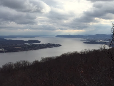
| Looking south down the Hudson |
 |
| Indian Point Nuclear Power Plant across from Jones Point |
 |
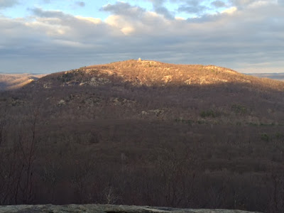
| Perkins Tower from the AT/Timp-Torne |

No comments:
Post a Comment