Harriman State Park - Kakiat and Pine Meadow Lake Loop
Hiked on July 4, 2016Parking
Going through Suffern, NY via Route 59, take Route 202 North about 3.5 miles to the entrance for Kakiat Park on the left.Trails
NYNJTC Map 118 (Harriman South)From the parking area, through the gate, over the foot bridge, follow the woods road
West (straight) onto Orange Mountain Trail
West (left) onto White Kakiat Trail
North (right) onto Black Circle Racoon Brook Hill Trail
North (right) onto Yellow Circle Poached Egg Trail
Left on woods road
East (right) onto Red Pine Meadow Trail
East (right) onto White Conklins Crossing Trail
South (right) onto Yellow Suffern-Bear Mountain Trail
East (left) onto White Kakiat Trail
Left onto Blue Old Mill Tail
Finish at woods road back to parking lot
Description
When I set out on this hike I wasn't expecting too much. I have hiked much of southern Harriman and it is very nice but I was pleasantly surprised by several aspects of this look - a thigh busting climb, some pristine woodland, rock scrambles, and a beautiful loop around Pine Meadow Lake. It was a very enjoyable hike.Park in Kakiat Park and head toward the bathroom hut to the path across the drive, near where cars enter the parking area. Continue on the wide path and cross the bridge. Keep going straight and you'll pass markers for the blue and white trails. Straight ahead and you'll see the Orange Mountain Trail marker. The Orange trail climbs up on Cobus Mountain with a couple of nice lookouts towards the east. They are a welcome stop to catch your breath. Past the power lines and the clearing for the gas pipeline, Orange ends into the White Kakiat Trail. Take a left (west) here. Be careful not to follow the woods road as I did.
Kakiat continues to climb and passes the Yellow Suffern-Bear Mountain (S-MB) trail. This is where we'll come back. Further on you're passing though forest where you can't even see the trail. You're just jumping from rock to rock and not hitting dirt. Without the blazes, there is no way to follow a trail. Truly a leave-no-trace area. Very nice. I found the trail a little hard to follow in places but didn't take more than a minute to find the next blaze.
Along Kakiat there were lots of blueberries and in early July there was lots to eat if the bush got some sun. Very nice. Kakiat edges the pipline and it was here that I got very close to a turkey. I was surprised it didn't run off, as they usually do as soon as they see you. I was wondering why and then I saw a little turkey chick dart in the bushes. That's why the mother was sticking around. Not wanting to be a nuisance, I just let them be and kept going.
At the intersection of the Black Circle on White Racoon Brook Hills Trail, take a right (north). Shortly you're climbing up a steep but short hill that takes some big steps and rock scrambling. There is even a wood ladder to help. A fun climb.
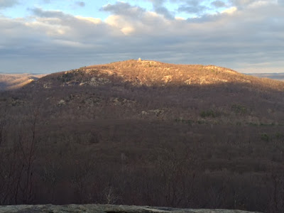
On the other side you'll begin to see the lake (or hear people if it's swimming weather). Look for the Yellow Circle Poached Egg trail which shortly leads to a woods road (Pine Meadow Road). Take a left at the road and follow it around the lake until you see the Red Pine Meadow Trail. There were lots of people sunning on the boulders and playing in the lake. At the Red trail there is a big No Swimming sign but I don't think it deterred anybody. Follow Red to the right continuing along the lake. There are many pockets here to get out to the lake edge and enjoy the view. I saw a couple of tents set up and thought it would be a great place to backpack when it isn't swim season.
Once Red heads away from the lake you'll see the White Conklin's Crossing trail heading east. Follow White to Yellow S-MB once again climbing Cobus Mountain (short for Jacobus?). Take a right and head south with a few ups and downs. In about 1 mile you'll intersect White Kakiat again. Go left (east) and start on the long way down. It gets a bit steep in spots and with the loose rocks you need to watch rolling. Once it levels out you are near the end. You can follow Kakiat back to the path to the parking area or take a left at the Blue Old Mill trail for a diversion. There are remnants of the sluice and mill on the creek.
My GPS tracker didn't work so I don't have an accurate mileage read, but I would estimate 5.5 miles. It took me about 4 hours with breaks.
Pictures
 |
| Blueberries are ripening |
 |
| Ladder on Raccoon Brook Hill Trail |
 |
| View of Pine Meadow Lake |
 |
| Fern Glade |
 |
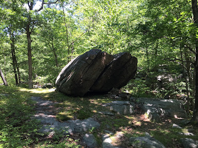
| Interesting split boulder (erratic maybe?) |


